
PECAS
PECAS is a generalized approach for simulating spatial economic systems. It is designed to provide a simulation of the land use
component of land use transport interactive modelling systems.
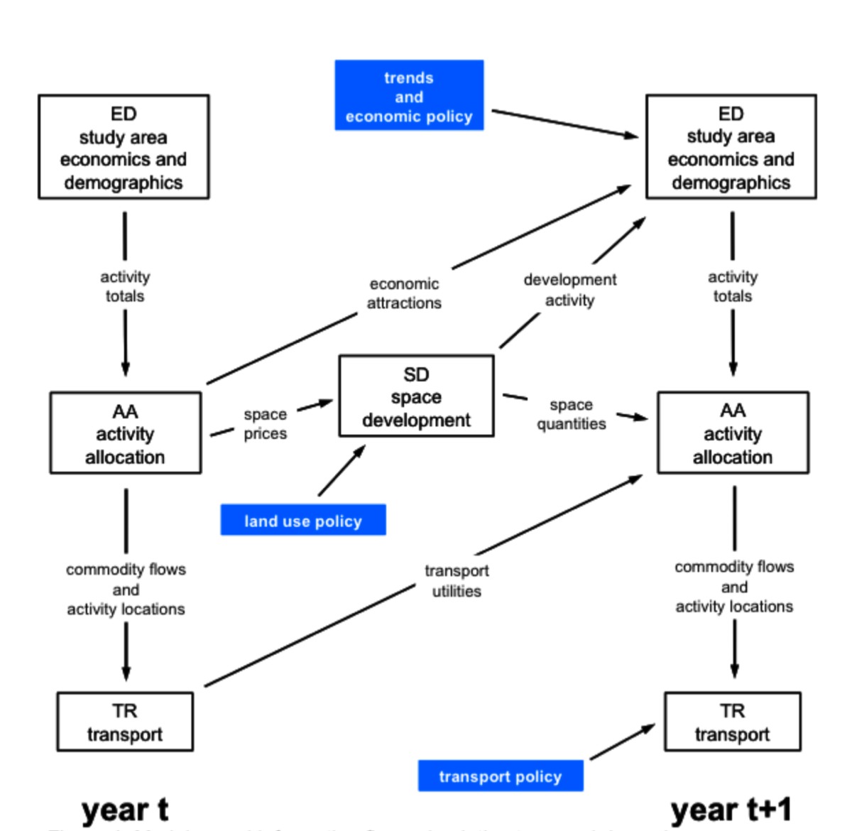
PECAS stands for Production, Exchange and Consumption Allocation System. Overall, it uses an aggregate, equilibrium structure with separate flows of exchanges (including goods, services, labour and space) going from production to consumption based on variable technical coefficients and market clearing with exchange prices. It provides an integrated representation of spatially distinct markets for the full range of exchanges, with the transport system and the development of space represented in more detail with specific treatments.
Flows of exchanges from production to exchange zones and from exchange zones to consumption are allocated using nested logit models according to exchange prices and transport generalized costs (expressed as transport utilities with negative signs). These flows are converted to transport demands that are loaded to networks in order to determine congested travel utilities. Exchange prices determined for space inform the calculation of changes in space thereby simulating developer actions. Developer actions are represented at either (a) the level of individual land parcels or grid cells using a microsimulation treatment or (b) the level of land use zones using an aggregate flow treatment. The system is run for each year being simulated, with the travel utilities and changes in space for one year influencing the flows of exchanges in the next year.
For more information on PECAS, including the User Guide and Theoretical Formulation, click on the links below,